


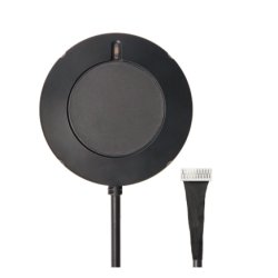
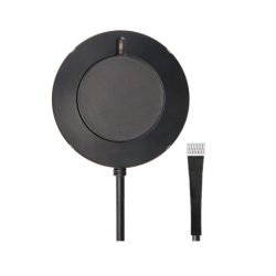
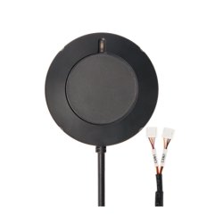

H-RTK NEO-F9P Rover (IP66, RM3100 Compass)
- SKU: MBS-SES-445
- Category: RTK / Positioning
-
Manufacturers:

H-RTK NEO-F9P Rover (IP66, RM3100 Compass)
- Multi-band RTK with u-blox NEO-F9P, centimetre-level accuracy
- Precise RM3100 compass, IP66 housing
- Available as UART 10-Pin, UART 6-Pin or DroneCAN 4-Pin
Description
Holybro H-RTK NEO-F9P Rover (IP66, RM3100 compass) – multi-band RTK GNSS for drones and vehicles
The Holybro H-RTK NEO-F9P Rover is an RTK GNSS module for centimetre-level positioning on drones, boats and land vehicles. It is based on the u-blox NEO-F9P, a multi-band receiver with L1/L5 support that uses up to four GNSS constellations concurrently and achieves an RTK solution very quickly thanks to multi-band DGNSS algorithms.
For precise heading data, the high-precision PNI RM3100 magnetometer is integrated, which operates without offset drift. A stacked ceramic patch antenna with hybrid coupler, SAW filter and LNA ensures clean signal reception, and a tri-colour LED indicates the status. The housing is protected against dust and water jets to IP66.
The module is available in three versions: UART 10-Pin (GPS1 Port) for the 10-pin GPS1 connector, UART 6-Pin (GPS2 Port) for the 6-pin GPS2 connector, and DroneCAN 4-Pin (CAN Port) with its own processor, IMU and barometer for the CAN bus.
Features
- Multi-band RTK with u-blox NEO-F9P, GPS L1 and L5
- Centimetre-level accuracy: RTK 0.01 m + 1 ppm CEP
- Fast RTK convergence thanks to multi-band DGNSS algorithms
- High-precision PNI RM3100 compass without offset drift
- Stacked ceramic patch antenna with hybrid coupler, SAW filter and LNA
- Advanced anti-spoofing algorithms
- Rugged IP66 housing
- Three versions: UART 10-Pin (GPS1 Port), UART 6-Pin (GPS2 Port) and DroneCAN 4-Pin (CAN Port)
Versions
| Version | Compatible port | Cable | Protocol | Processor | IMU & barometer | Holybro SKU |
|---|---|---|---|---|---|---|
| UART 10-Pin (GPS1 Port) | Holybro GPS1 port | GH1.25, 10-pin | UART | – | – | 12060 |
| UART 6-Pin (GPS2 Port) | Holybro or CubePilot GPS2 port | GH1.25, 6-pin | UART | – | – | 12061 |
| DroneCAN 4-Pin (CAN Port) | Pixhawk CAN port | GH1.25, 4-pin | DroneCAN, 1 Mbit/s | STM32G473 | ICM42688 & ICP20100 | 12072 |
Technical data
| GNSS receiver | u-blox NEO-F9P |
| GNSS constellations | GPS/QZSS, GLONASS, Galileo, BeiDou |
| Frequency bands | L1C/A, L1OF, L5, E1B/C, E5a, B1I, B2a |
| Concurrent GNSS | 4 |
| Magnetometer | PNI RM3100 |
| Heading accuracy (dynamic) | 0.3° |
| Horizontal accuracy | PVT 1.5 m CEP · SBAS 1.0 m CEP · RTK 0.01 m + 1 ppm CEP |
| Vertical accuracy | PVT 2.0 m R50 · SBAS 1.5 m R50 · RTK 0.01 m + 1 ppm R50 |
| Time to first fix | Hot start 3 s · Aided start 4 s · Cold start 27 s |
| Navigation update rate | RTK max. 7 Hz · PVT max. 7 Hz · RAW 10 Hz (GPS+GLO+GAL+BDS) |
| GNSS protocols | NMEA, UBX binary, RTCM 3.3, SPARTN 2.0.1 |
| Operational limits | Dynamics ≤ 4 g · Altitude 80,000 m · Velocity 500 m/s |
| Antenna | Stacked ceramic patch antenna |
| Antenna gain | L1: 1.8 dBi · L5: 0.5 dBi · LNA: 28 ± 2 dB |
| Application | Rover (UAV, marine, land vehicles, etc.) |
| Operating voltage | 4.75–5.25 V |
| Current consumption | approx. 250 mA |
| Operating temperature | −25 to +85 °C |
| Cable length | 40 cm (default) |
| Communication | UART (UART 10-Pin / UART 6-Pin) or DroneCAN 1 Mbit/s (DroneCAN 4-Pin) |
| Dimensions | Ø 61.99 mm, height 21 mm |
| Weight | 63.5 g |
| Protection rating | IP66 |
Scope of delivery
UART 10-Pin (GPS1 Port)
- 1× H-RTK NEO-F9P Rover (RM3100), UART
- 1× Connection cable GH1.25, 10-pin
- 1× UART to USB converter
- 1× Carbon fibre antenna stand with mounting hardware
UART 6-Pin (GPS2 Port)
- 1× H-RTK NEO-F9P Rover (RM3100), UART
- 1× Connection cable GH1.25, 6-pin
- 1× UART to USB converter
- 1× Carbon fibre antenna stand with mounting hardware
DroneCAN 4-Pin (CAN Port)
- 1× H-RTK NEO-F9P Rover (RM3100), DroneCAN
- 1× Connection cable GH1.25, 4-pin
- 1× Carbon fibre antenna stand with mounting hardware
Notes
- RTK operation requires a source of correction data, e.g. your own base station or an NTRIP service.
- Compatible with PX4 and ArduPilot. With two modules, GPS heading (moving baseline) is also possible.
| Item information | Value |
|---|---|
| Shipping weight: | 0,20 kg |
| Item weight: | 0,06 kg |
Reviews
There are no reviews yet.

