YUJIN YRL Series | 3D LiDAR Review
LiDAR are critical components that are extensively used in robotic applications such as autonomous navigation, object collision avoidance, mapping, etc. Several varieties of LiDARs are available and are utilized depending on the application, e.g. simple obstacle collision or a 2D map may be constructed using a 2D LiDAR. For more advanced applications such as 3D map building, 3D LiDARs are required.
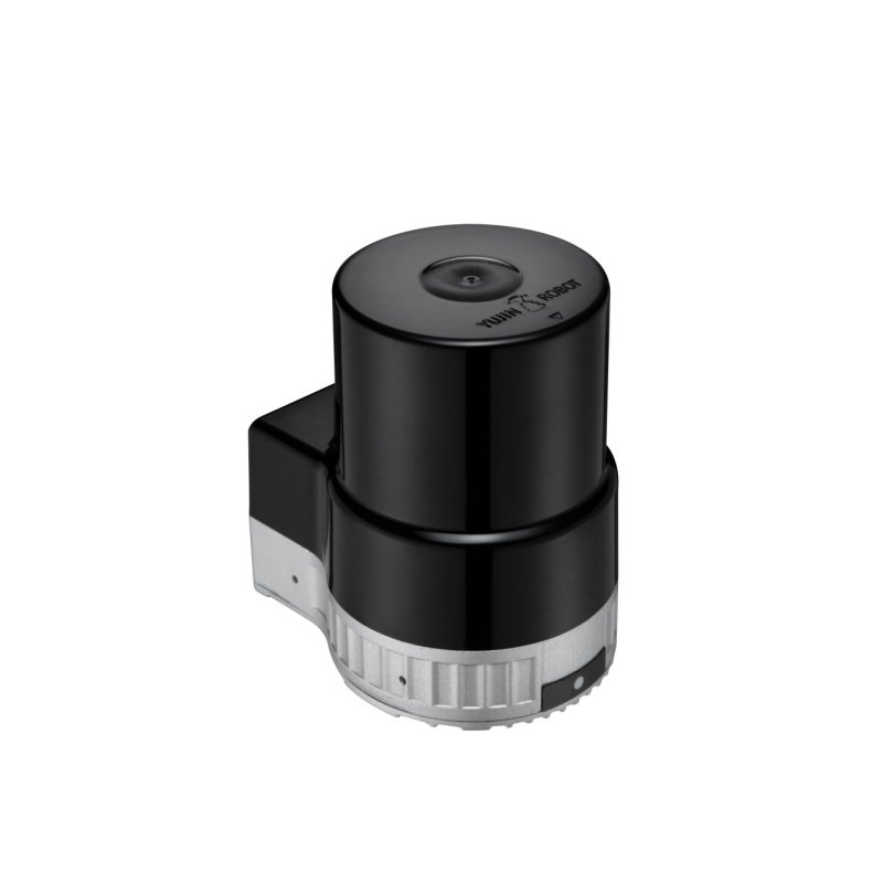
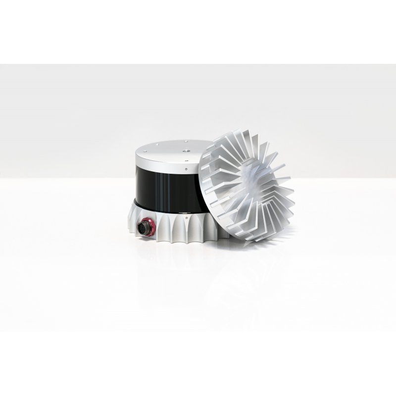
Today we will reviewing the YUJIN YRL series 3D LiDAR scanner. This a very cost-effective solution for 3D scanning. Several of it's prominent features are its 270° horizontal scan range, 90° vertical scan range, ROS support, low power consumption, and finally, its low price in comparison to its competitors. First, we will discuss the software setup for this LiDAR then secondly, we will view its output results both in its native server as well as in ROS and then finally, we will discuss the Pros and Cons of this LiDAR in comparison to some other LiDARs.
YUJIN YRL3-20 Software Operation
Software Requirement
For the software installation. The following is required:
- Ubuntu 18.04
- ROS melodic
Software Installation
- The first step for installation is to clone the YUJIN repository into your catkin_ws src folder via:
cd catkin_ws/src git clone git@github.com:yujinrobot/yujin_lidar.git - The next step is to install its dependencies:
cd .. rosdep install --from-paths src --ignore-src -r -y - We correct the ws directory via:
cd src/yujin_lidar/yujin_lidar_rosmelodic_driver_ubuntu1804/yujin_yrl_package/src gedit yrl_pub.cpp- In line 96 change the file path to /home/
/catkin_ws/utils/lk.bin
- In line 96 change the file path to /home/
- We add a utils folder:
cd
cd catkin_ws
mkdir utils
- We then build the workspace:
catkin build
source devel/setup.bash
LiDAR Network
-
Set up a static connection for your computer by going to settings, then select the network. Add a new connection by clicking the + sign.
- At this stage you may give the connection a name such as yujin
-
Goto the IPV4 tab and change the connection to manual. Insert the IP address 192.168.1.12 and the network as 255.255.255.0.
-
Click Add and then power-cycle your network and switch to the static network.
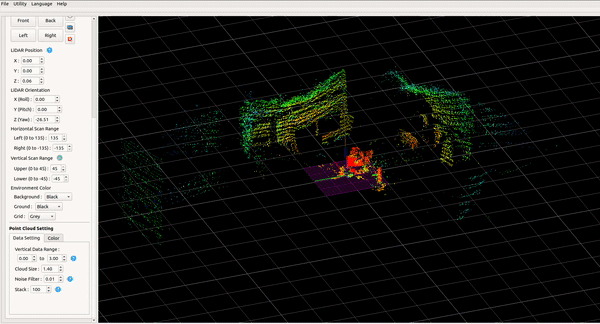
LiDAR Calibration
-
Navigate it to
yujin_lidar/yujin_lidar_viewer_ubuntu1804/ -
Make the file executable:
sudo chmod +x ./Yujin_Lidar_Viewer
- Run the viewer:
./Yujin_Lidar_Viewer
- Connect to the LiDar via which usually has the IP 192.168.1.250
- A status icon turns green when you are successfully connected.
-
Generate a calibration file by clicking on the Utility and then Create a Calibration File.
-
Once the file is generated, press Utility again and this time click Import a Calibration File.
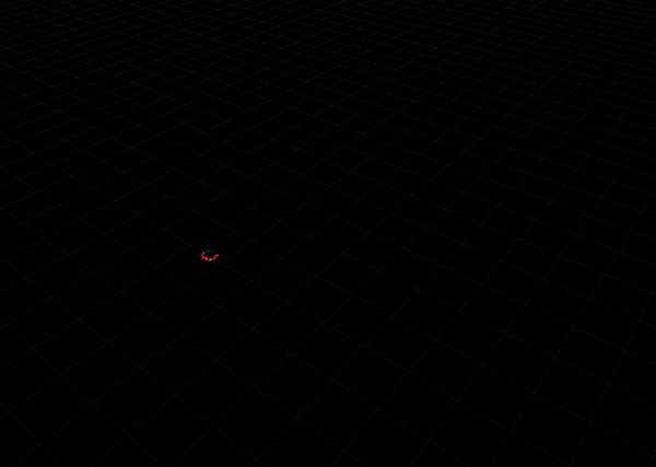
- This should now display the LiDAR's point cloud.
- Rename the calibration file to lk.bin and copy it over to your /home/
/catkin_ws/utils/ folder.
Operating LiDAR in ROS
- Ensure your workspace is sourced:
cd
cd catkin_ws
source devel/setup.bash
- Run the roscore:
roscore
- Run the yujin driver:
rosrun yujin_yrl_package yrl_pub
- Run rviz:
rosrun rviz rviz
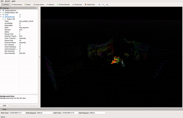
- In the left display panel, select Add. Then in the opened menu select By topic and then under /yrl_pub/yrl_cloud select PointCloud2.
- The point cloud should be visible now.
- You can play with PointCloud2 features, located on the display panel. A recommended change is to set the Decay time from 0 to 10. This will allow the recorded points to decay over 10 seconds instead of immediately.
Comparative Analysis
|
|
|
|
|
|---|---|---|---|
| Model | |
 |
 |
| Horizontal Scan Range |
|
|
|
| Vertical Scan Range |
|
|
|
| Resolution (Horizontal) |
|
|
|
| Max. Range |
|
|
|
| Voltage |
|
|
|
| ROS Compatibility |
|
|
|
| Pricing |
|
|
|
Synopsis
All in all the Yujin YRL3 series LiDAR is a cost-effective LiDAR with very good documentation. However, compared to its competitors, it lacks simultaneous point cloud detection. This might be considered both a good and a not-so-good feature. Good in the sense that, it does not flood the communication channels with data points and scans reasonably fast; Not so good in the sense that in sensitive applications where real-time data is required of every point simultaneously, it cannot provide that data fast enough. In terms of robotics, it works well for slow-moving robots and is a good option. If funds are not an issue then definitely, Ouster would be the ideal solution as it is capable highly accurate point clouds with a range of 50 m (Ouster OS0 / up to 120m with Ouster OS1) and up to 240 m in some of its higher-end series. Also, a few minutes of the point clouds recorded with the Ouster results in over 5 Gb of data stored.
YUJIN YRL3-20 Links
Note:
Please email at support@mybotshop.de in case you find any incorrect statements, facts, typos, or if you think some additional information should be added.